Scanners reveal a wreck on the bottom of Lake Geneva

© 2011 elemo / EPFL
The Russian submersibles involved in EPFL’s elemo project have discovered a new wreck on the bottom of the lake. Underwater archaeology is benefiting from scanners developed for scientific research.
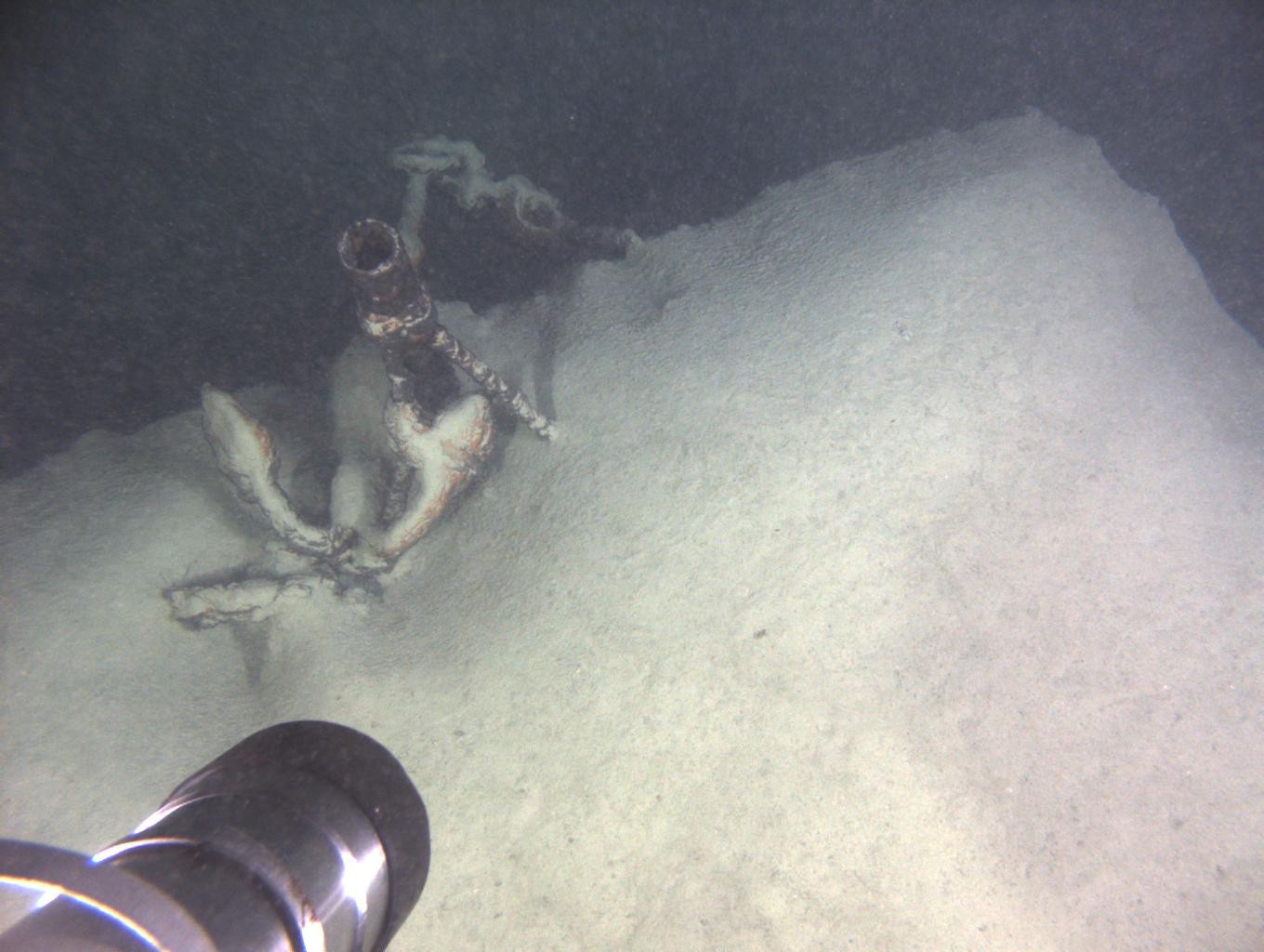
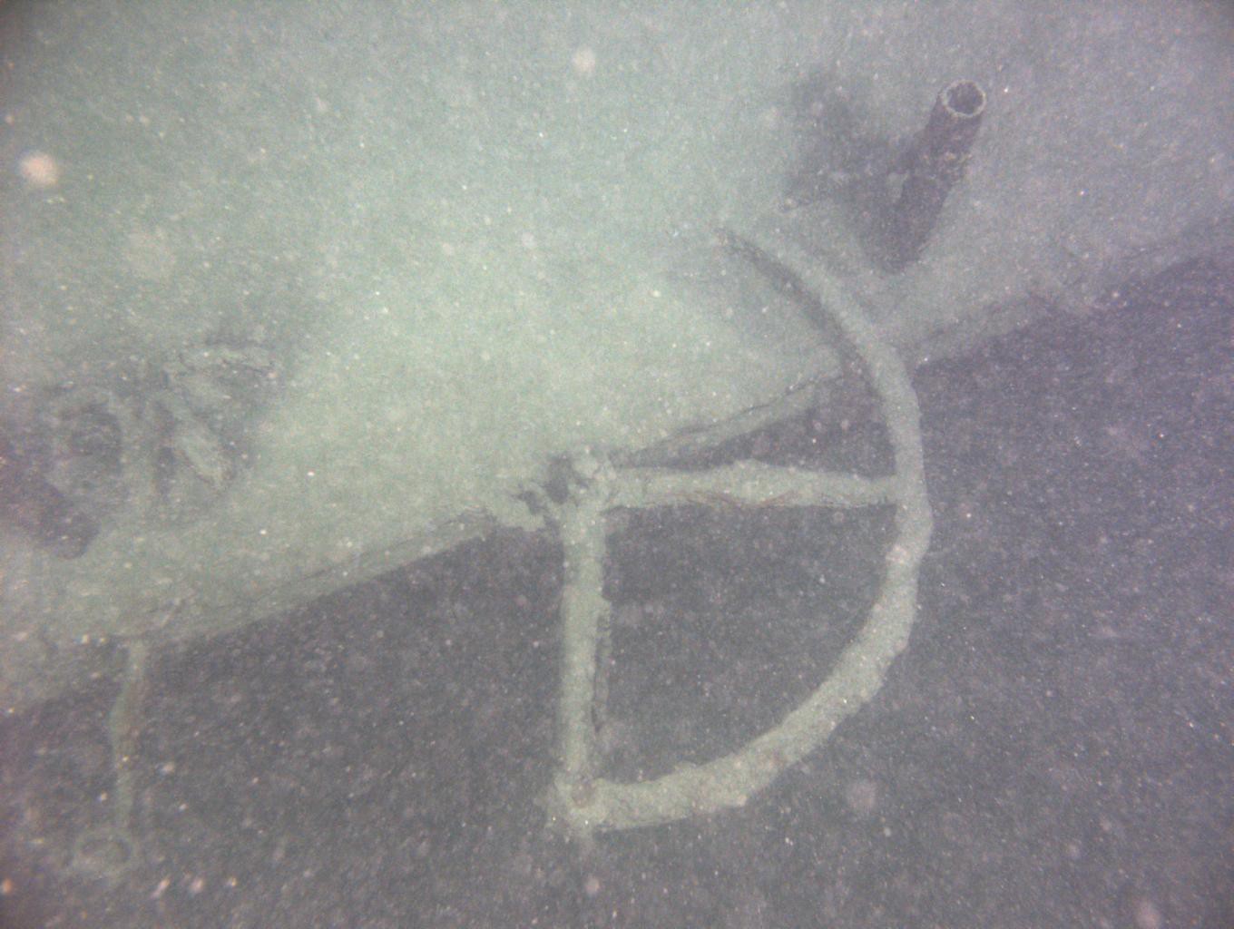
“It’s always a memorable moment when you find an unknown shipwreck. It’s not on the maps, and after having gone around it, I didn’t see any inscription on its hull,” explains Evgeny Chernyaev, who was piloting the submersible. Diving off the shores of la Tour-de-Peilz, he was taking sediment samples. The sonar indicated a large object off to one side. It was a sunken boat. The team was lucky; the portholes provide only a very limited range of vision and the sonar only sweeps 200m in front of the submersible, with an arc of 90°. The wreck is most likely an old barge used for hauling stone or gravel.
“The boat, about 30 meters long, could date from the end of the 19th or beginning of the 20th century. It must have sunk while navigating, because the anchor and other components were still on board, whereas boats that were sunk deliberately would have been stripped of all useful equipment,” explains Carinne Bertola, from the Musée du Léman in Nyon. Bertola, a specialist in shipwrecks, thinks that it was an old barge that transported materials extracted from quarries in the St. Gingolph area. The pilot confirms this: “The state of the wreck leads me to think that it dates to the same time as that of the Rhône, which is not far away.”
Researchers take advantage of a scanner
At the bottom of the lake, where objects are covered in sediment and the visibility is bad, explorers can easily go right by a discovery. Fortunately, during this dive, Marie-Eve Randlett from EAWAG and Don Dansereau from the Australian Centre for Field Robotics were using a high-resolution scanner. This instrument helps them position the submersible correctly to take sediment samples at the desired depth, as well as make a precise map of the lake bottom.
This device, developed in Australia, combines video images and ultrasound maps – like those taken in medical ultrasounds – to obtain a representation of depth. The scientists take 3m x 3m photos, or more than 200,000 images in all, to cover 100,000 square meters. It’s an enormous amount of meticulous work to make a high resolution map and to better understand sedimentation processes. The scientists were thus able to obtain a detailed image of the barge’s deck, despite the thick layer of sediments.
As-yet unexplored depths
“There’s still no precise map of the entire lake bottom. Archaeological research predicts that we should still have many surprises. All the more so because historians have not yet examined the archived documents from lifesaving associations,” adds Bertola. Boats have navigated Lake Geneva since ancient times, so the scanner may turn out to be an indispensable tool for revealing even older wrecks, buried under thick layers of sediment laid down over the centuries.
Document:
Letter from Lake Geneva Rescue Services (Société de Sauvetage), 28th of May 1909. Credit: Archives de Vevy / Musée du Léman
Links:
http://www.elemo.ch/
Images to download